Examples of oil fires in Kuwait &
Iraqs seen in Meteosat Images
Occasionally some special
features are visible in Meteosat images. Especially in the high resolution
visible image (2.5km x 2.5km resolution at sub-satellite point) those features
are best observable.
In the image sequences below
two examples of black smoke plumes resulting from oil fires in Kuwait and
Iraq are shown. The first sequence was taken during the gulf war in 1991,
while the second sequence was seen in early 1997.
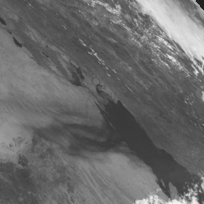
This sequence shows the
burning oil fields in Kuwait in April 1991. A squence of eight visible
images taken in around midday on 7th April 1991 (8.00 Z to 12.00
Z).
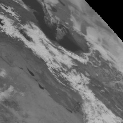
In this image sequence a single explosion type
of fire was seen in Iraq's mainland in early 1997. The images were taken
on 29 January 1997 around midday (8.00 Z to 12 Z).
If you have any questions
or queries about EUMETSAT, its products and services, please contact us
by sending an e-mail to ops@eumetsat.de.